1
/
of
1
Large Map
Large Map
No reviews
Regular price
£9.00
Regular price
Sale price
£9.00
Unit price
/
per
Shipping calculated at checkout.
Couldn't load pickup availability
Free Postage
For orders over £100
Secure Checkout
Secure Payment
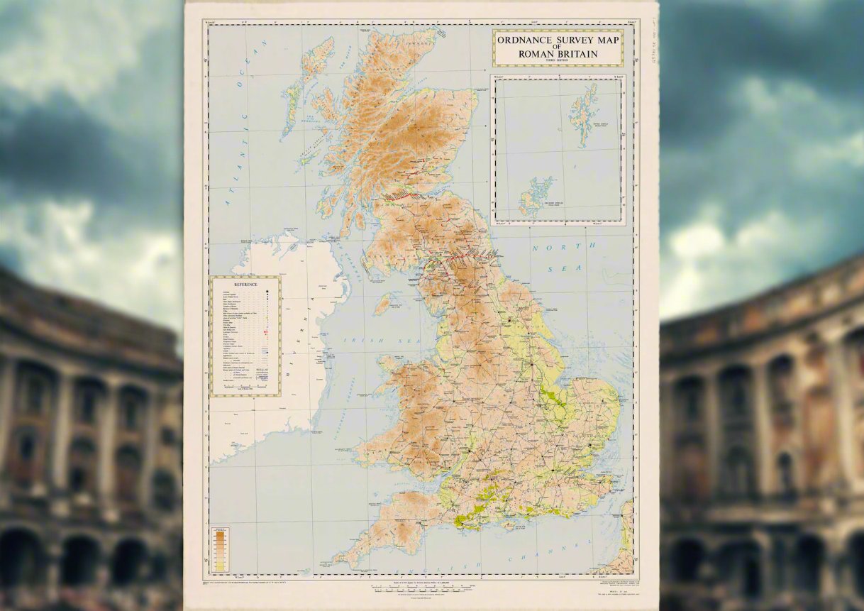
This Large Ordnance Survey Map of Roman Britain is an exceptionally detailed and high-quality reproduction that offers a comprehensive view of Roman Britain at its height, perfect for both educational and decorative purposes.
- Dimensions: Approx. 105cm tall x 80cm wide, this large map provides an expansive, detailed layout that makes it ideal for display in classrooms, museums, or as part of a private collection.
- Material: Printed on durable, high-quality paper, this map retains clear and sharp detailing, with vibrant colours to ensure its longevity and clarity. It is suitable for framing or hanging as a centrepiece in any space dedicated to ancient history.
- Historical Content: The map provides an in-depth visual representation of Roman Britain, featuring key Roman settlements, military fortifications, roads, and boundaries. It includes famous sites like Hadrian's Wall, the network of Roman roads stretching across Britain, and strategic forts such as Vindolanda and Portchester.
- Roman Influence: This map illustrates how the Romans organised and controlled Britain, showcasing their advanced engineering, military strategies, and the cultural impact they had on the region. It highlights the divisions of Roman Britain into provinces such as Britannia Superior and Britannia Inferior.
-
Educational Value: Perfect for studying the Roman Empire’s impact on Britain, this map can serve as a visual aid for understanding key aspects such as:
- Roman military presence and fortifications.
- The extensive road network that helped maintain Roman control.
- Urbanisation and the development of Roman towns.
- Trade routes and their role in economic integration within the empire.
- The spread of Roman culture and influence throughout the island.
- Ideal for History Enthusiasts and Educators: This map is a fantastic resource for history educators looking to bring Roman Britain to life for students. It is also a wonderful addition for collectors of Roman history artefacts or those interested in visualising the historical geography of ancient Britain.
Whether used as an educational tool, a reference for study, or simply as an attractive and informative decoration, this Large Ordnance Survey Map of Roman Britain will help bring history to life, offering a deeper understanding of Britain’s place within the Roman Empire.


